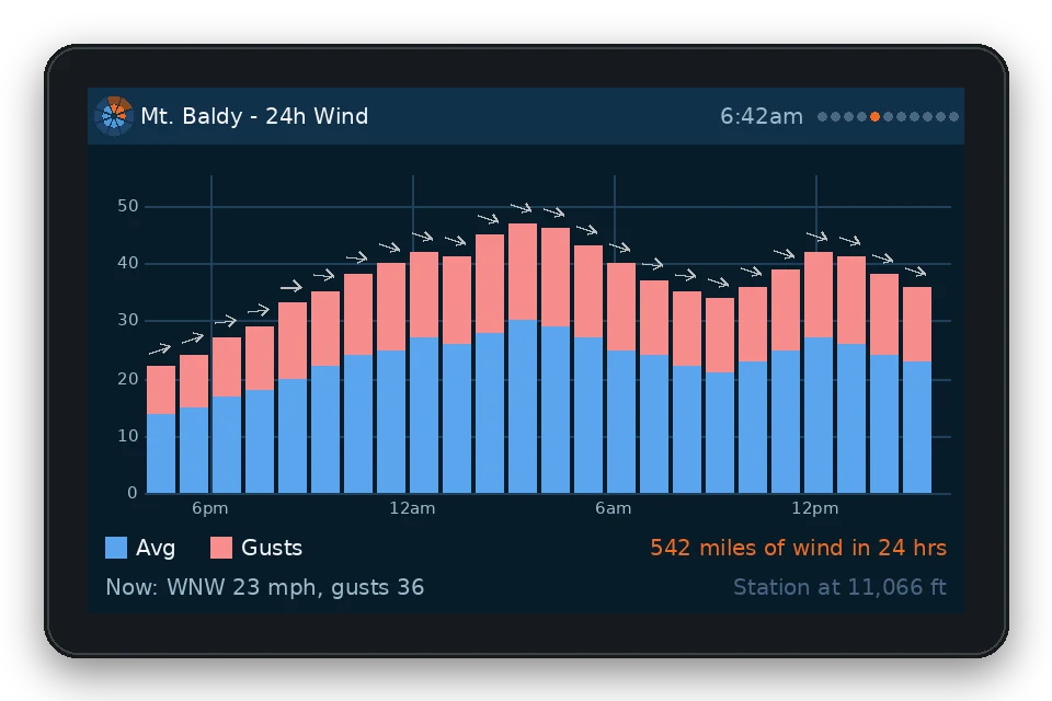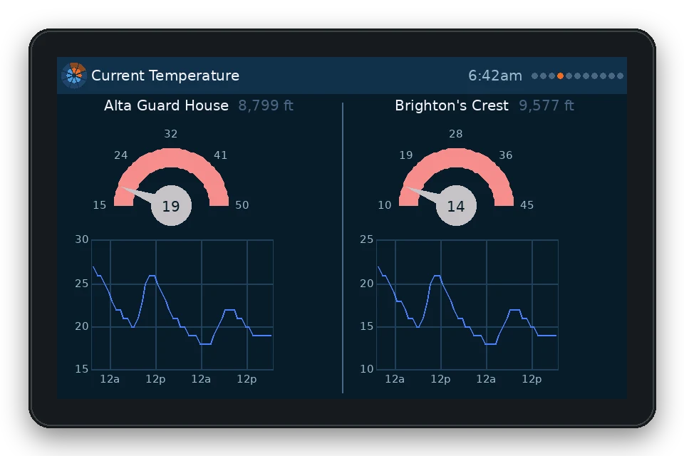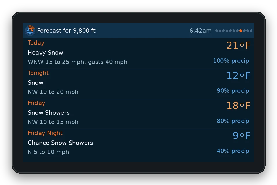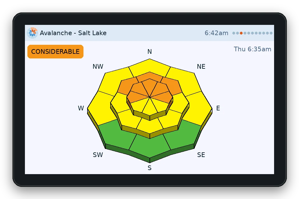
A tiny screen for the mudroom wall

Today's avalanche forecast, before you load the car.

PowDash is a small touchscreen for your counter, fridge or mudroom that shows the avalanche danger, new snow, the snow forecast and live radar for the zone you ride. No app to open, no tabs to dig through. Glance at it while you pull your boots on.

No subscription · No ads · Built in Utah · $1 of every unit goes to avalanche forecasting

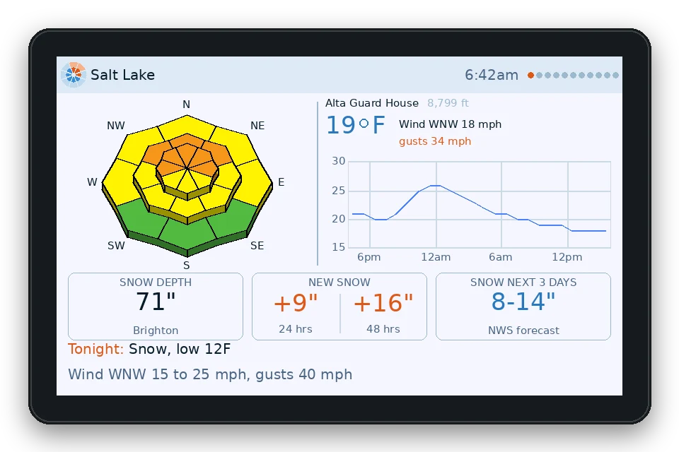
A PowDash 4.3-inch unit showing current conditions at Alta, new snow, snow depth, the avalanche danger rose and the snow expected over the next three days
Near Mount Superior, Little Cottonwood, UT

From every PowDash sold goes to avalanche forecasting.

PowDash only works because avalanche centers publish a forecast every morning. So a dollar from each unit goes back to the nonprofit or center that forecasts the area it was set up for, paid out each season and listed here once it's sent.

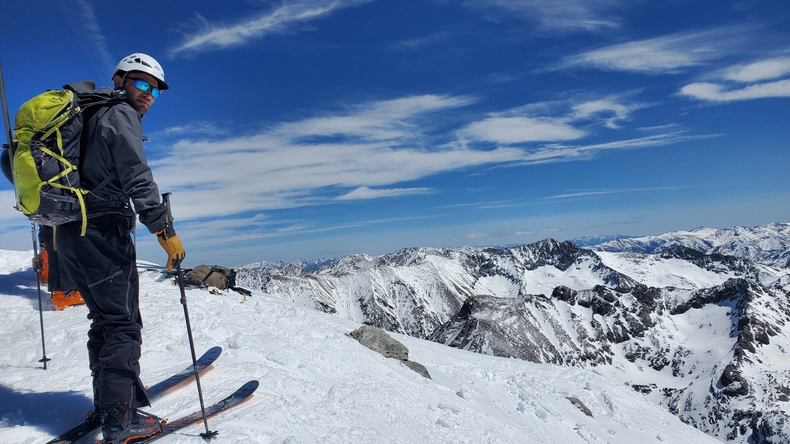
The maker of PowDash on a snowy summit with skis, peaks and blue sky behind

A small project

Made by one skier and sledder, for the people I ride with.

Every morning in winter I did the same thing: open the avalanche forecast, then the snow report, then the radar, then the SNOTEL numbers, on a phone, half awake. I wanted all of it on one screen I could read from across the kitchen.

So I built one. PowDash started as a cheap display on my counter and turned into something friends kept asking for. This first run is about 100 units, assembled and tested by hand. There's no investor and no growth plan, just a tool I use every day and want to get right.

If you ski, ride, sled or guide, you're who this is for. Tell me what's missing and I'll build it.

Built in Utah · first run, winter 2026–27

Is it deep enough to ride? Is it safe to go?

Those are the two questions. PowDash answers the first a few days out and the second the morning of.

How you use it

Plan the week from the kitchen. Check the morning of.

PowDash isn't just a weather screen. It's how I decide where to go: watch where the snow is stacking up, pick a zone that's deep enough to ride, then confirm the avalanche forecast for that zone before I leave.

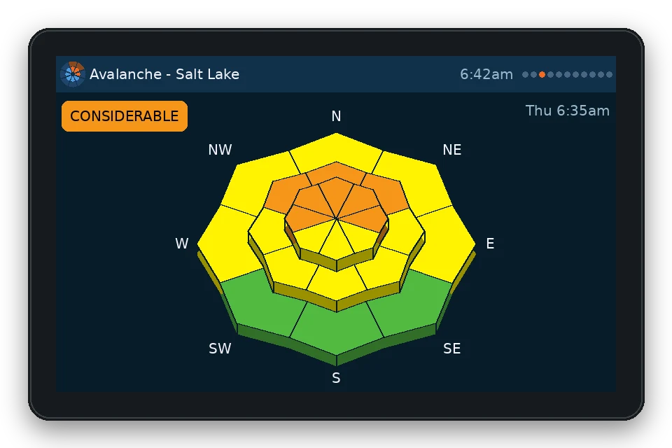
  1. The avalanche page: today's danger rose by aspect and elevation, with the danger rating Every day

    Today's rose on the fridge

    Magnets are built in, so it sticks right on the fridge, or stands up on the counter on its own stand. The day's avalanche rose and danger rating are up before you've made coffee, and everyone in the house sees them without opening an app.

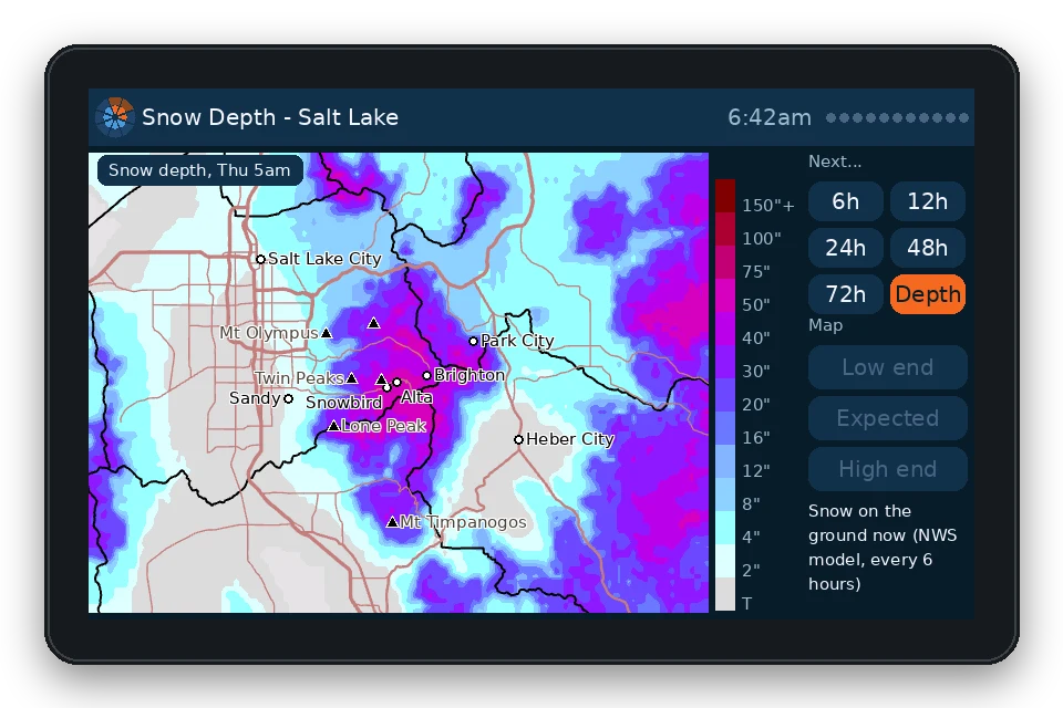
  2. The snow depth map: snow on the ground across the Salt Lake zone, deepest in the Cottonwoods, with place names Days ahead

    Pick where it's deep enough

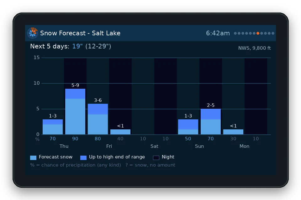
    Use the forecast snowfall and snow depth maps to plan zones and routes. See which drainages are getting hit, where there's enough base to cover the rocks and stumps, and where the sleds will float instead of trench.

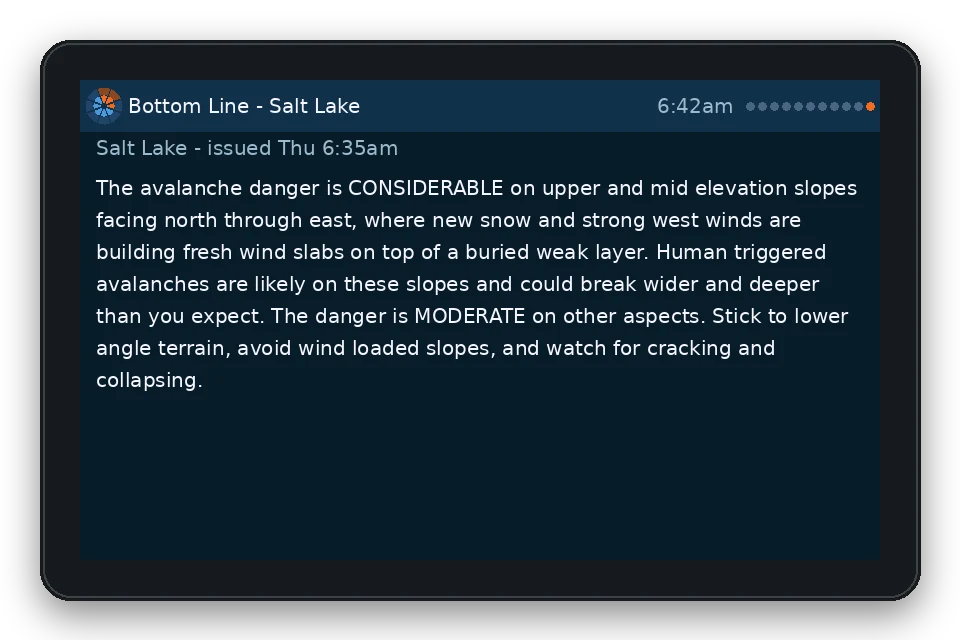
  3. The bottom line page: the avalanche center's summary for today in plain words Morning of

    Verify before you go

    Check the avalanche forecast and bottom line for the zone you picked, on the day you're going. If it doesn't line up with the plan, change the plan. Then read the full forecast from your avalanche center.

No subscription. No ads.

Buy it once and it's yours. No monthly fee, no ads, no account, no app. Updates and new areas come over Wi-Fi for free.

What it shows

Everything you check before a tour, on pages that turn on their own.

PowDash flips through its pages every few seconds, or stays put when you tap. The screens below are drawn from the device's own layouts, with real map layers for the Salt Lake zone. The snow depth map is the NWS snow model from February 19, 2026; the other numbers are samples.

Avalanche page: a tilted danger rose by aspect and elevation, with the Considerable ratingBottom line page: the forecaster's summary, word for word

The avalanche forecast for your zone

The danger rose for every aspect and elevation band, the overall rating and the forecaster's bottom line, straight from your local center as soon as it's published.

  • Upper, middle and lower elevations stacked like the terrain, in the colors the centers use
  • The bottom line, word for word, on its own page
  • Shows when the forecast was issued

Utah Avalanche Center · avalanche.org forecast centers
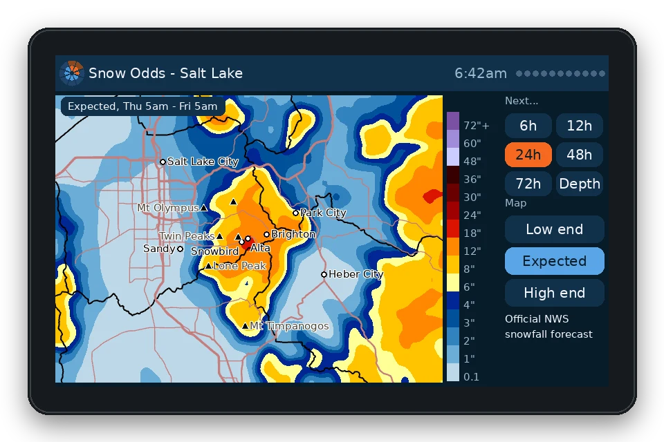
Snow odds page: a map from Salt Lake City to Heber shaded by expected snowfall, heaviest over the Cottonwoods, with buttons for 6 to 72 hours and low, expected and high endSnow depth page: snow on the ground across the same map, deepest in the Cottonwoods

Snowfall odds, mapped over your terrain

The National Weather Service's probabilistic snow maps, zoomed in to about 60 miles around your area, with towns, peaks, highways and county lines on top.

  • Low end, expected and high end amounts
  • 6, 12, 24, 48 and 72 hour windows
  • A snow-depth map of what's on the ground right now

NWS Weather Prediction Center · NOAA NOHRSC

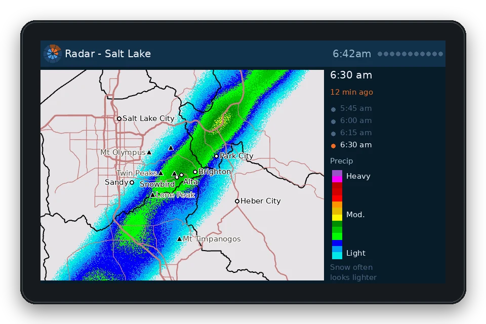
Radar page: the last hour of radar looping over the same map, with frame times and a precipitation legend

Radar on the same map

The last hour of radar loops over the same base map as the snow forecast, so you can see whether that band is about to hit your trailhead.

  • Updates every 15 minutes
  • Option to hide the faint speckle that isn't real snow

NEXRAD via Iowa Environmental Mesonet

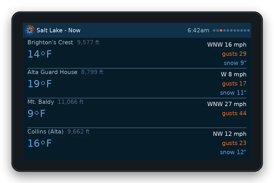
Home page: current temperature and wind at a high station, new snow, snow depth, the danger rose and the snow expected over the next three days

The morning check, on one screen

The home page puts it together: the danger rose, the temperature and wind up high, snow depth, new snow, and how much is coming in the next three days.

  • Tonight's forecast along the bottom
  • Weather alerts show up across the bottom when there are any

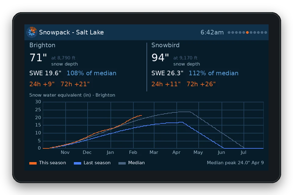
National Weather Service · NRCS SNOTEL · mountain weather stations

And the rest of the pages

Webcams

Highway and resort cameras near your zone, two at a time.

Weather alerts

Winter storm warnings and other alerts show in the header. Tap for the full text.

Uses your Wi-Fi

It connects to your home Wi-Fi and pulls new data every few minutes.

Updates itself

New features and new areas install automatically over Wi-Fi.

Pick your pages

Turn pages on or off, set how long each one stays up, or pin one.

Dark or light

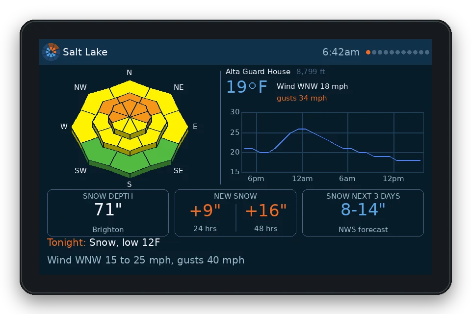
A night-navy theme, a snow-white one, or light by day and dark after sunset.

The avalanche page in the dark theme
Dark
The avalanche page in the light theme
Light
Skis or sleds, the questions in the morning are the same: how much fell, what's the danger, and is more coming.

Where it works

Pick your zone from the menu.

Each unit shows one forecast zone at a time and you can switch whenever you like. More areas get added over the air as avalanche centers come on board.

Utah Utah Avalanche Center

AbajosLoganMoabOgdenProvoSalt LakeSkylineSouthwestUintasCedar CityLoganOgdenSalt LakeProvoUintasSkylineSouthwestMoabAbajosUTAH

Southwest Montana Gallatin NF Avalanche Center

MTWYYellowstoneBridger RangeCooke CityIsland ParkLionhead AreaNorthern Gallatin RangeNorthern Madison RangeSouthern Gallatin RangeSouthern Madison RangeBozemanWest YellowstoneBridger RangeN. GallatinN. MadisonS. GallatinS. MadisonLionheadIsland ParkCooke City

Zone outlines from the avalanche centers' public forecast maps. Hover or tap a zone to highlight it.

Next up tell me where you ride

Know the storm is coming before you go to bed.

Snow odds, radar and the next morning's forecast, sitting on the counter. Then you just have to set the alarm.

Get one

First run · about 100 units

Get a PowDash.

PowDash in the light theme, showing the home page for the Salt Lake zone
PowDash 4.3″

Big enough to read across the room. Every page, every update, no subscription.

  • Avalanche, snow maps, radar, stations, snowpack and webcams
  • 800 × 480 touchscreen
  • Built-in magnets and fold-out stand
  • About 4″ × 3″ × ½″, USB-C powered

$60 plus tax

Buy PowDash

One price, no subscription. Checkout is handled by Stripe. Ships this winter to the US. Sales tax is added at checkout where it applies. $1 of every unit goes to avalanche forecasting.

Feedback welcome

Tell me what to build next.

Every feature on PowDash started as somebody's "it would be great if it showed…". If you own one, or want one, I read every message.

sales@powdash.co

Ideas on the list

  • Areas Colorado, Idaho and Wyoming forecast zones
  • Snowmobile Trail grooming reports and riding-area closures
  • Tours Wind direction and speed on ridgetops, by hour
  • Alerts A heads-up when the danger rating goes up overnight
  • Hardware A battery version for the cabin

Questions

Good to know

Is PowDash a safety device?
No. It's a convenient way to see the forecast. Always read the full forecast from your avalanche center, check conditions yourself, and carry rescue gear and the training to use it.
Is it affiliated with an avalanche center?
No. PowDash is an independent project. It shows forecasts that centers publish for everyone, credits them on screen, and sends them a dollar from each sale.
Is there a subscription?
No. You pay once. There's no monthly fee, no ads and no account, and software updates and new areas are free.
How big is it, and how does it mount?
About 4″ × 3″ × ½″. It has magnets built in for the fridge or any steel surface, and an integrated stand for a counter or shelf.
What does it need to work?
Home Wi-Fi and a USB-C power supply. There's no account to create and no app to install.
My area isn't listed.
Send a note. New areas are added as centers and data sources allow, and requests decide what comes next.